Ville Mayenne 1944
As I commence my Ville Mayenne build I wanted to look at the buildings that were destroyed by allied bombing during the preparation and during the landings so I could add them to my build. The archives here have a number of useful photos I thought I would add. Also some before and after shots of the area I want to build. This post is more of an overview, the follow post will more in detail to the Ville.
 |
| Ville Mayenne, at the top is the German barracks and the route to Oisseau and the radar station |
 |
| A close up of the two road bridges, on the left is the Basilica bridge, on the right is the bridge in front of The Grand Hotel now known as the McCracken bridge. |
 |
| Bombing in June 1944 on the south east bank of the river,the absolutely hammered section is the railway station and stock yards |
 |
| Looking from McCracken bridge towards the renaissance bridge in the foreground and the railway viaduct in the background. Both were demolished by the Germans after the breakout occurred at Avaranches on the 2nd of August. |
 |
| This photo really shows the depth of the embankment looking at the basilica of Norte Dame in the background, just to the left was the renaissance bridge and too the right about 100m is the McCracken bridge. |
 |
| Facing southeast the bridge to the right is the McCracken bridge, in the foreground are the lavoir and former water Mill, in the background is the edge of the Military hospital. The bridge had 6 500lb bombs strapped under the arches by the Germans in preparation to destruction. |
 |
| The Hospice, further upstream from the McCracken bridge, the former Moulin was full of refugees at the time of the bombing of the city by American aircraft in June. |
 |
| The Railway Viaduct, designed by Gustavo Eiffel, destroyed by the Germans in August 44, below this you can see the weir. Opposite are the gate keepers house and a Floch Maison behind had a German garrison, which was captured on the 5th of August by members of the 90th inf division. |
 |
| The Basilica of Notre Dame des Miracles, many of the medieval buildings were damaged or destroyed by the bombing in June, to the left is the chateau, the forked road to the left goes up to the marketplace |
 |
| The Carolingian Chateau of Mayenne, it was being used as a transit prison for German forced labour, to the right is the Basilica |
 |
| A photo from the 60’s, however a good view of the south east bank staging area for the linen barges |
Photos of the damaged Basilica from the June 44 bombing
 |
| The damaged church at the hospital, the hospital and hospice had more than 300 casualties from the bombing in June 44 |
 |
| The damaged railway Viaduct, looking back towards the city side of the river |
 |
| The flattened railway switch yards |
 |
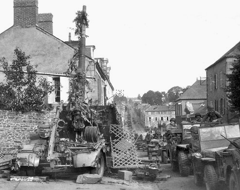
| The route to Aaron, much of the fighting between the 5th and 13th of August occurred in the southeastern part of the city |
Another view of the switch yards, the line to the right went over the viaduct
A view back towards McCracken bridge North toward the Barracks and the route to Oisseau, Ernée, Fougeres after the city was taken, three 88mm guns defended the south eastern side of the river along with two flak 20mm.
Next installment will be the city streets and some more photos from the fighting.
Cheers
Matt


No comments:
Post a Comment